In brief
Scientists at Vantor released before‑and‑after satellite images that chart the terror of a Wednesday flash flood on the Trishuli River after a glacier collapsed. The images show villages, a bridge and a hydro‑electric power station washed away, a Nepal‑Tibet border crossing submerged, and villages scattered eight kilometres downstream. More than 550 people died, hundreds are missing, and a barrier lake formed at the bottom of the landslide threatens a second flood. Rescue teams struggle as the lake blocks efforts and Chinese authorities limit media access on the Tibetan side.
Satellite images released by the intelligence firm Vantor show the devastation caused by Wednesday’s flash flood that struck Nepal’s Trishuli River valley after a massive glacier collapse.
The before‑and‑after shots reveal entire villages, a bridge and a hydro‑electric power station obliterated by the torrent. A key Nepal‑Tibet border crossing was swallowed by the rush of water and captured on ground‑level footage.
Officials report more than 550 deaths and hundreds missing. The damage spreads up to 2.5 km upstream and 100 m above the riverbed.
The flood also devastated the village of Timure, while the town of Trishuli, some 45 km downstream, has been reduced to mud‑filled ruins.
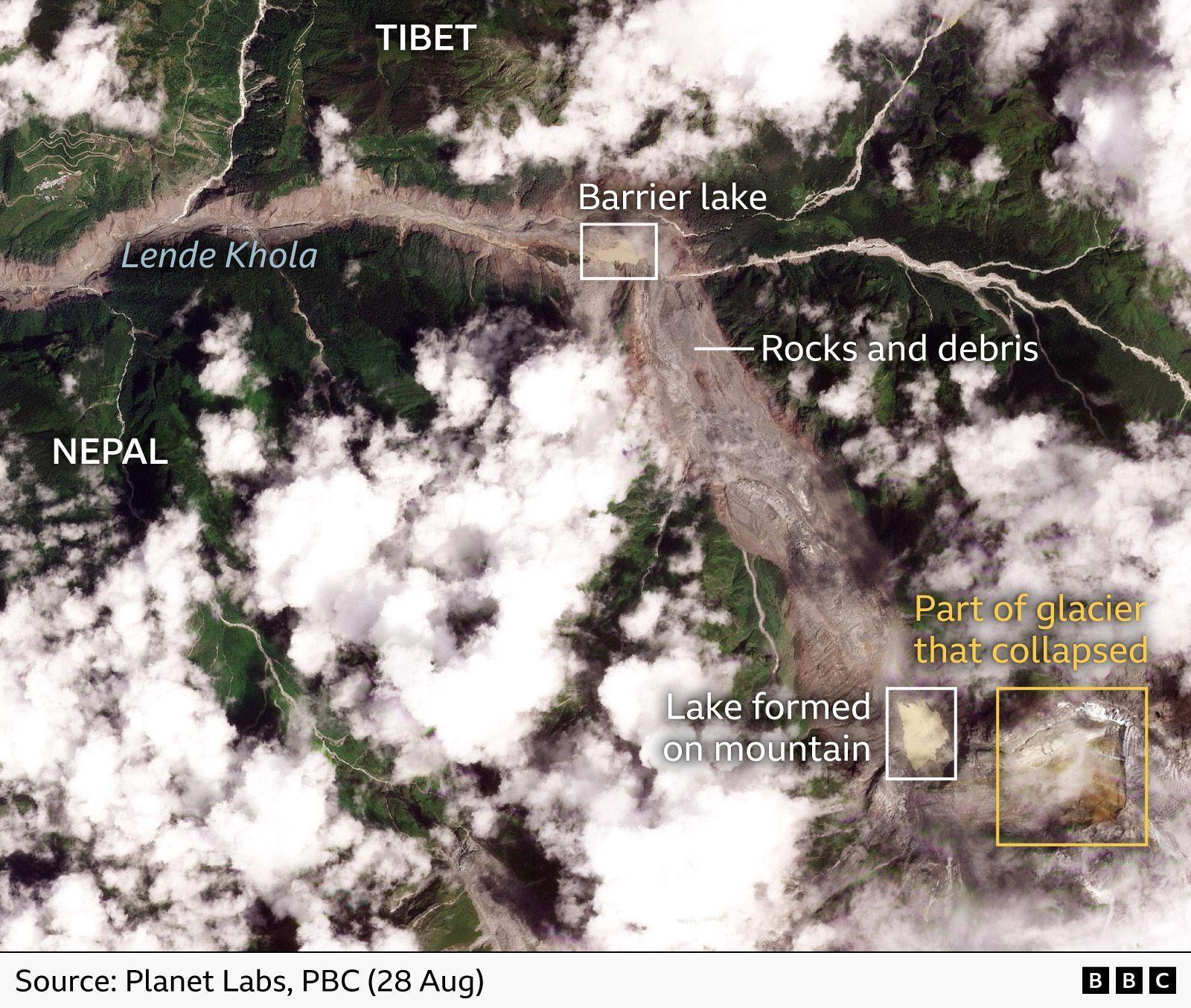
New imagery from Planet Labs pinpoints a huge block that fell from the glacier, carving a chaotic valley that has now cradled a barrier lake at its base. The lake poses a potential second flood risk but appears stable, with a visible drainage channel indicated in the images.
Chinese authorities have warned that the barrier lake poses a major risk, and their restricted media access on the Tibetan side has limited verified footage on that side of the border.
The satellite data from Vantor’s Open Data Program helps aid teams identify where to focus rescue efforts, locate missing people and recover the dead.