In brief
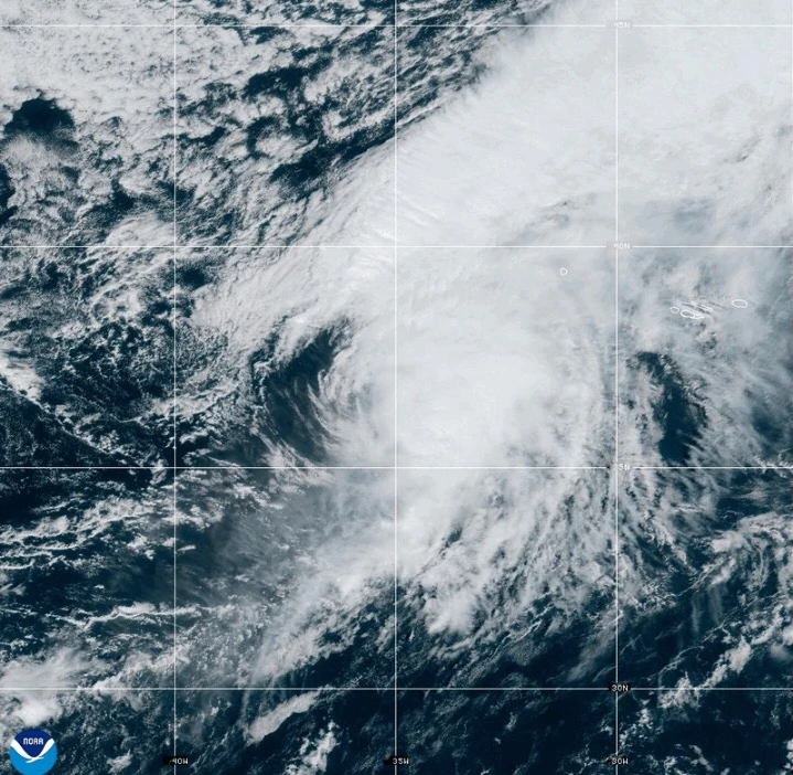
The Azores islands are preparing for Hurricane Gabrielle, which is approximately 455 miles west of the archipelago. With maximum sustained winds of 75 mph, the storm is expected to bring significant rain and hazardous conditions, including dangerous surf. Preparations must be completed swiftly as coastal flooding and flash floods are likely.
MIAMI (AP) — A fast-moving Hurricane Gabrielle is expected to bring heavy rain, high winds, and a storm surge to the Azores islands starting Thursday evening and extending into early Friday, according to forecasters.
A hurricane warning has been issued for all islands in the volcanic archipelago, with officials urging residents to finalize storm preparations. The Miami-based National Hurricane Center has warned that dangerous conditions from Gabrielle are imminent.
By Thursday afternoon, Gabrielle was located approximately 455 miles (730 kilometers) west of the Azores, boasting maximum sustained winds of 75 mph (120 kph) and moving east at 32 mph (52 kph).
Swells generated by the storm will likely result in life-threatening surf and rip current conditions, impacting the Azores, along with Bermuda, the northeastern U.S. coast, and Atlantic Canada.
As it passes through the Azores, Gabrielle is expected to retain hurricane strength before weakening over the weekend. However, significant hurricane-force wind gusts can still be expected even after the storm's center passes.
The storm is predicted to deliver up to 5 inches (13 centimeters) of rain across central Azores, leading to potential flash flooding, especially in mountainous areas. The eastern and western parts of the archipelago could see up to 3 inches (8 centimeters) of rain.
A dangerous storm surge, accompanied by large and destructive waves, could produce significant coastal flooding in areas with onshore winds.
Meanwhile, Tropical Storm Humberto, formed near Caribbean islands, was positioned460 miles (750 kilometers) east-northeast of the northern Leeward Islands with winds reaching 50 mph (85 kph) on Thursday morning. Humberto is on a northwest trajectory at 8 mph (13 kph) and is expected to become a hurricane soon.
In the Pacific, Hurricane Narda was moving away from Mexico, showing gusts of up to 90 mph (150 kph) as it traveled west-northwest.
The approaching waves from Narda may also pose risks of life-threatening surf and rip currents along parts of coastal Mexico, expected to reach southern California by weekend.