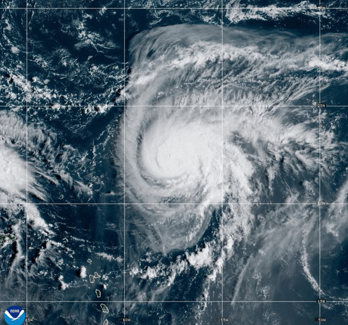
MIAMI (AP) — Dangerous tropical weather brewed Saturday in the Atlantic, with Hurricane Humberto intensifying into a powerful Category 4 hurricane and another weather system threatening the Southeast U.S.
According to the latest advisories from the Miami-based National Hurricane Center, Hurricane Humberto boasts maximum sustained winds of 145 mph (230 kph) and is currently positioned about 375 miles (605 kilometers) northeast of the northern Leeward Islands, moving west at 6 mph (9 kph).
Forecasters warn that Humberto could result in life-threatening surf and rip currents for the northern Leeward Islands, the Virgin Islands, Puerto Rico, and Bermuda throughout the weekend.
Meanwhile, a separate weather system is set to develop into a tropical storm over the weekend, posing severe rainfall and flash flooding threats to the Bahamas and Cuba, with parts of the Bahamas already under tropical storm warnings.
This same system is projected to approach the Southeast U.S. early next week, gradually strengthening into a tropical storm by Sunday and potentially reaching hurricane status by late Monday.
In response to the approaching storm, South Carolina Governor Henry McMaster declared a state of emergency on Friday evening, allowing state emergency officials to coordinate actions with local and federal governments and ensuring eligibility for federal aid.
Preparatory measures have begun in Charleston, South Carolina, with crews assembling sandbags, checking high-water vehicles, and getting pumps ready to mitigate potential floodwaters. Even though this has not formed yet, we are treating it as if we are expecting some kind of impact, said Chief Fire Marshal Michael Julazadeh.
Domestically, the tropical disturbance has already led to heavy rainfall in the Dominican Republic, causing evacuations and a red alert in five provinces due to severe flooding, blocking access to numerous communities.
The Federal Emergency Management Agency cautions coastal residents in the Southeast U.S. to stay vigilant as the weather system continues to evolve, with staff prepared to respond swiftly if needed.
In the eastern Atlantic, post-tropical cyclone Gabrielle has moved away from the Azores, and while hurricane warnings for the Portuguese archipelago have been discontinued, significant surf and rip currents are expected to affect Portugal and nearby regions.
Out in the Pacific, Hurricane Narda is maintaining strength and continues to generate dangerous swells impacting coastal Mexico, warning residents of potential rip current risks.